


Lowrance: app for anglers
4.1432.00 Reviews
App Specs
- Version
- 4.6.0
- Updated On
- License
- Free
- Downloads
- 500,000+
- Developer
- Navico Norway AS
- Categories
- Maps & Navigation
- Platform
- Android
Screenshots
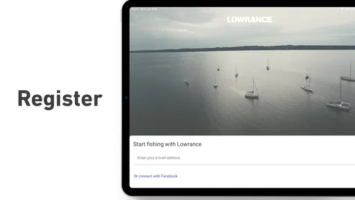
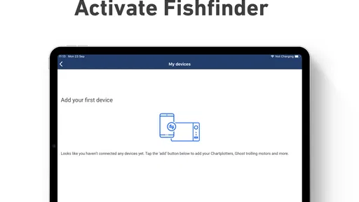
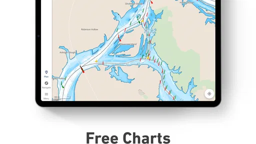
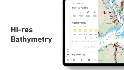
 Analysis by AppCompare
If you’re like me and love spending a day out on the water fishing, then you’re going to want to check out the Lowrance app. This nifty little tool is like having a personal fishing assistant tucked right into your pocket. Whether you’re a seasoned angler or just starting out, this app offers a ton of features to enhance your fishing experience.
Where it fits in an angler’s routine
I see the main appeal as keeping fishing plans and useful information together, rather than treating this as a general-purpose navigation app. It is made by Navico Norway AS, and its focus on fishing maps and trip planning gives it a different job from a road-navigation app or a broad outdoor map. Those alternatives may be better for driving to a launch point or finding a trail, but they are not necessarily built around the choices anglers make once they reach the water.
A realistic use for me would start the evening before a trip: I would look over the water area, think through a route, and check the conditions I need to consider before deciding when to leave. On the water, I would use the map as one reference while staying alert to changing weather and local conditions. Afterward, a catch record can help me remember what worked. That sequence—plan, navigate, reflect—is more useful than opening an app only after I am already trying to decide where to fish.
The app is free to download, but it also offers in-app purchases ranging from $14.99 to $89.99 per item. I would treat that as a reason to explore the free experience and understand what I personally need before paying for anything. A higher-priced add-on is not automatically worthwhile for every angler; the value depends on whether its maps or other tools match the waters and habits you actually have.
What Does the Lowrance App Offer?
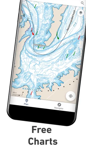
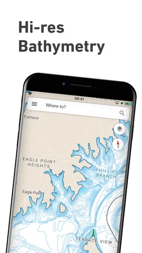
Alright, let’s dive into the good stuff. The Lowrance app is packed with features designed to make your fishing trips more productive and enjoyable. One of my favorite features is the detailed mapping. You get access to high-resolution charts that help you navigate waters like a pro. The charts are intuitive and easy to read, which is super helpful when you’re out there trying to find the best spots.
But wait, there’s more! The app also offers real-time weather updates. This is a game-changer for anyone who’s been caught in unexpected weather while fishing. You can plan your trip around the best times and conditions, keeping an eye on wind speeds, temperature, and more. It’s like having your own weather station at sea.
Planning before you leave
For a new user, I would begin with a modest test rather than building a whole trip around the app immediately. Open the map for a familiar area, check whether its layout helps you understand the water, and make a simple plan before relying on it somewhere unfamiliar. That gives you a chance to learn how the charts feel on your phone and whether they suit the way you make decisions outdoors.
Worth Reading Before You Choose

EA SPORTS FC Mobile 26 Is a Bigger Football Game, but It Takes Time

Flipboard Shows What News Apps Must Do Beyond the Feed

Switching to Android Auto Means Rethinking Your Driving Routine

Google Calendar Makes a Crowded Week Easier to Manage

Ludo King Makes the Most of the Minutes Between Plans

Baby Panda World Brings Quick Play to Modern Phones, but Its Game Library Feels Busy
One practical trade-off is that a map on a phone is still only one part of safe navigation. I would not let an appealing chart or a convenient route distract me from checking the conditions and using sensible judgment on the water. If you are going somewhere remote, think ahead about what information you will need and whether you can access it there. A trip planner is most helpful when it is part of preparation, not a substitute for it.
Catch Logs and More!
Another cool feature is the catch log. You can easily record your catches with details like size, weight, and location. This is super handy if you’re trying to track patterns or just want to show off your big catches to your friends. The app also allows you to take photos of your catches and store them, creating a visual diary of your fishing adventures.
I would use a catch log less as a scoreboard and more as a way to make future outings smarter. If I note the location and basic details consistently, I can later compare trips instead of relying on a vague memory of where the fish were. A small habit makes the record more useful: enter the details soon after a catch, while they are fresh, and keep entries reasonably consistent. Photos can add context, but the value comes from recording enough information to recognize a pattern later.
Reading the water and choosing tools
The sonar feature is another highlight worth mentioning. If you’re serious about fishing, this is a must-have. It gives you a clear view of what’s happening underwater, helping you identify fish and structures. The sonar is easy to interpret, and you can customize it to show the information that matters most to you.
There is an important distinction here for anyone deciding whether to install the app: map-based planning and sonar are not the same kind of help. A map can support decisions about where to go, while sonar is aimed at understanding what is beneath you. If you mainly fish from shore and do not use compatible sonar equipment, that part may be less relevant to your routine. If you are a boat angler who already works with sonar, it may make the app more compelling. I would choose based on the equipment and fishing style I actually have, not on the assumption that every feature will matter equally.
Compared with relying on a general map app, the fishing-specific approach is the point: it is meant to bring water-focused charts and trip planning into the same place as angling tools. A general navigation app can still be more convenient for the drive, while a paper chart or another dedicated navigation option may suit someone who prefers a non-phone reference. I would not expect one tool to replace every other one; the useful choice depends on whether the task is getting to the lake, planning on the water, or recording a catch.
User-Friendly Interface
One thing I appreciate about the Lowrance app is how user-friendly it is. Navigating through the app is a breeze, and everything is laid out in a way that makes sense. Even if you’re not tech-savvy, you’ll find it easy to use. The design is sleek and modern, with a focus on functionality.
Even a straightforward layout takes some getting used to when you are outdoors, so I would explore it at home rather than while steering or handling fishing gear. Try the screens you expect to use, learn where the map and planning tools sit, and decide what you want to check before heading out. This is a small step, but it reduces the temptation to fiddle with a phone at the wrong moment.
The app also offers social features, allowing you to connect with other anglers. You can share tips, tricks, and even your favorite fishing spots. It’s a great way to become part of a community and learn from others who share your passion.
Sharing a location is a personal choice, especially if a spot is private or meaningful to you. I would think through whether a tip is something I want to share broadly or only with people I trust. That kind of decision matters more than the convenience of a share button: anglers may value community, but they may also want to keep their own notes and favorite places private.
Trust, permissions, and personal choices
Because a fishing map can involve location and trip details, I would review the phone’s permission prompts carefully and grant only the access that makes sense for the way I use the app. I would also check the app’s privacy information and account settings directly before adding personal details or sharing anything. Those are sensible checks for any navigation tool, and I would not assume that a feature’s presence tells me how its data is handled.
My practical approach is to separate using a map for a trip from sharing information socially. I would first try the planning tools with the choices I am comfortable making, then decide whether connecting with others adds enough value to justify sharing. If a permission request appears that does not fit the task I am trying to do, I would pause and consider whether that feature is essential to me rather than accepting automatically.
The app is rated for Everyone, which makes its audience broad, but that does not remove the need for adults to make thoughtful decisions about a child’s location or shared fishing information. I would be particularly careful about posting precise locations or trip plans publicly. The user remains responsible for what they choose to record and share.
Compatibility and Accessibility
The app is available for both Android and iOS, which is a big plus. You can download it from the Google Play Store or the Apple App Store, and it’s compatible with most devices. Setting up the app is straightforward, and there are plenty of resources available if you need help getting started.
On Android, the current version is 4.6.0 and requires Android 10 or later. The app has more than 100,000 installs, with an average rating of 3.6 from around 3,000 ratings and 398 written reviews. I take that as a mixed public reception rather than a guarantee of how it will work for me: the best test is whether its map coverage and tools fit my regular fishing areas and device.
For those of us who like to fish in remote areas, the app offers offline mapping. You can download maps ahead of time, ensuring you have access to all the features even without a cell signal. This is perfect for those off-the-grid fishing adventures.
For an offline trip, preparation is the key practical detail. I would download the areas I expect to use while I still have a dependable connection, then check that they are available before setting off. I would not wait until reaching a remote launch to find out whether I have what I need. Offline maps can help with a loss of signal, but they do not make a phone infallible; keeping the device charged and having a backup plan still matters.
Who will get the most from it?
I think it is best suited to anglers who regularly plan outings on the water, value fishing-focused maps, and want to keep trip preparation and catch notes close at hand. Someone who fishes a familiar shoreline occasionally may find a simpler map and a notebook perfectly adequate. Likewise, if your main need is road directions, this is not the app I would choose for that job. Its strengths make most sense when fishing itself—not merely travel to the water—is the center of the task.
If you are trying it for the first time, I would start with a nearby, familiar fishing area and one clear goal, such as checking the map or recording a catch. That lets you judge whether the app adds useful detail without making a high-stakes trip depend on an unfamiliar workflow. If the charts are useful and the planning tools fit your routine, you can explore further; if not, there is little reason to buy extras just because they are available.
Final Thoughts
In conclusion, the Lowrance app is a fantastic tool for anglers of all levels. It’s packed with features that not only make fishing more enjoyable but also more successful. From detailed mapping to real-time weather updates and social features, it’s got everything you need to up your fishing game.
Whether you’re out on the lake every weekend or just enjoy the occasional fishing trip, this app is worth checking out. It’s like having a fishing buddy who knows all the best spots, and let’s be honest, who wouldn’t want that?
So, next time you’re planning a fishing trip, make sure the Lowrance app is part of your gear. Happy fishing!
Pros
- User-friendly interface for easy navigation.
- Real-time weather updates for fishing spots.
- Customizable maps for specific needs.
- Seamless syncing with Lowrance devices.
- Offline maps available for remote areas.
Cons
- Limited features in free version.
- Requires strong GPS signal for accuracy.
- Battery drain due to continuous GPS use.
- Occasional app crashes reported.
- Subscription needed for premium features.
FAQs for Lowrance: app for anglers
What features does the Lowrance app offer for anglers?
The Lowrance app provides a comprehensive suite of features for anglers, including detailed nautical maps, real-time weather updates, and customizable sonar charts. You can mark waypoints, track your trips, and share data with your Lowrance fishfinder. The app also offers community sharing, allowing you to connect with other anglers and share fishing hotspots.
Is the Lowrance app compatible with all Lowrance devices?
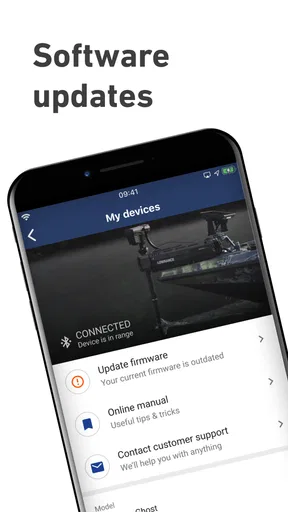
The Lowrance app is designed to work seamlessly with a wide range of Lowrance devices, including fishfinders and chartplotters. However, it's recommended to check the compatibility list provided on the app’s official website or within the app store description to ensure your specific model is supported. Firmware updates may be required for optimal integration.
How does the Lowrance app enhance the fishing experience?
The Lowrance app enhances the fishing experience by providing advanced mapping tools and sonar features that help anglers locate fish more efficiently. The app’s ability to sync with Lowrance devices means you can plan trips, save routes, and access detailed nautical charts directly from your mobile device, making it a powerful tool for both casual and professional anglers.
Is the Lowrance app available for both Android and iOS devices?
Yes, the Lowrance app is available for both Android and iOS devices. You can download it from the Google Play Store for Android devices and the Apple App Store for iOS devices. Ensure your device meets the minimum system requirements for optimal performance, as outlined in the app’s store listing.
Does the Lowrance app require a subscription or one-time purchase?
The Lowrance app offers both free and premium features. While basic functionalities are available for free, accessing advanced features such as detailed map layers, premium nautical charts, and additional weather data may require a subscription. Users can choose from various subscription plans based on their needs, ensuring flexibility and value.


